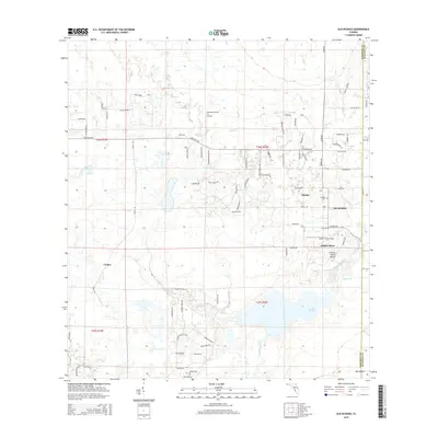
2015 Map of Old Myakka
USGS Topo · Published 2015About this map
Old Myakka and Miakka anchor this landscape in eastern Sarasota County, where the transition from agricultural tracts to the wetlands of the Myakka River basin is clearly defined. The terrain is marked by significant hydrological features, including the sprawling Lake Myakka and the Cow Pen Slough Canal, which speak to the complex water management history of this part of Florida. Cultural and historical sites are dispersed throughout the region, most notably the Caloosa Indian Mound situated near the riverbanks, representing an ancient layer of human habitation. Small rural communities like Utopia and Bee Island are connected by a network of local roads such as Fruitville Rd and Carlton Rd, while aviation is represented by private facilities like Hidden River Airport. The inclusion of the Myakka Cem provides a focal point for genealogical interest in this long-settled rural corridor.
Find a feature on this map
82 named features on this map. Tap any name to fly to it.
Don’t see what you’re looking for? This feature index may not catch every label — zoom into the map to look around manually.
Map Details
Editions of this 2015 Old Myakka Map
This is the sole edition of this map. No revisions or reprints were ever made.
Other maps of this area

1943 · Laurel
USGS Topo · 1:24,000

1944 · Lower Myakka Lake
USGS Topo · 1:31,680

1944 · Verna
USGS Topo · 1:31,680

1944 · Laurel
USGS Topo · 1:31,680

1944 · Lorraine
USGS Topo · 1:31,680

1944 · Miakka
USGS Topo · 1:31,680

1947 · Bee Ridge
USGS Topo · 1:24,000

1956 · Myakka City
USGS Topo · 1:24,000

1956 · Myakka City NW
USGS Topo · 1:24,000

1956 · Murdock NW
USGS Topo · 1:24,000