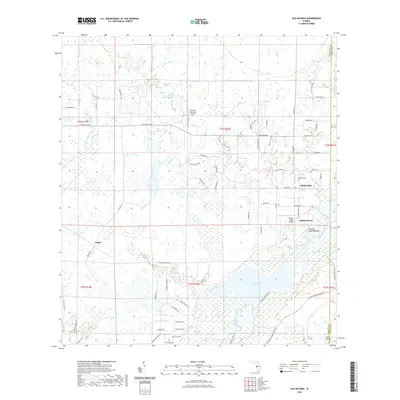
2021 Map of Old Myakka
USGS Topo · Published 2021About this map
Old Myakka and the surrounding Sarasota County landscape are defined by the winding course of the Myakka River as it feeds into the expansive Lake Myakka. This interior region of Florida shows a complex network of waterways, including Gum Slough, Indian Cr, and the Cow Pen Slough Canal, which reflect long-standing efforts to manage the wetlands and prairies of the Gulf Coast hinterland. The map provides significant archaeological and local history markers, notably the Caloosa Indian Mound situated near the riverbanks and the Myakka Cem located just north of the village center. Residential pockets like Hidden River and Utopia appear alongside small airstrips such as Hidden River Airport, suggesting a modern-day integration of rural living and aviation. To the south, the Myakka River State Park Trl indicates the transition into protected conservation lands that preserve the area's native character.
Find a feature on this map
72 named features on this map. Tap any name to fly to it.
Don’t see what you’re looking for? This feature index may not catch every label — zoom into the map to look around manually.
Map Details
Editions of this 2021 Old Myakka Map
This is the sole edition of this map. No revisions or reprints were ever made.
Other maps of this area

1943 · Laurel
USGS Topo · 1:24,000

1944 · Lower Myakka Lake
USGS Topo · 1:31,680

1944 · Verna
USGS Topo · 1:31,680

1944 · Laurel
USGS Topo · 1:31,680

1944 · Lorraine
USGS Topo · 1:31,680

1944 · Miakka
USGS Topo · 1:31,680

1947 · Bee Ridge
USGS Topo · 1:24,000

1956 · Myakka City
USGS Topo · 1:24,000

1956 · Myakka City NW
USGS Topo · 1:24,000

1956 · Murdock NW
USGS Topo · 1:24,000