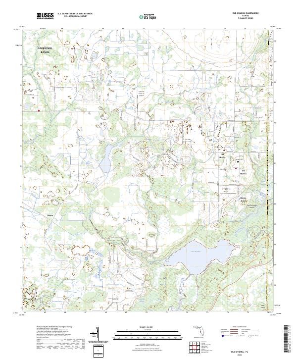
2024 Map of Old Myakka
USGS Topo · Published 2024About this map
Old Myakka and Old Miakka anchor this landscape along the border of Sarasota and Manatee counties, where the Myakka River system creates a sprawling network of wetlands and sloughs. The terrain is defined by its water-rich geography, including the broad Lake Myakka and the Vanderipe Slough, which drain south toward the coast. Cultural history is evident in the Caloosa Indian Mound located near the riverbank, indicating long-standing human presence well before modern ranching and residential growth. While Lakewood Ranch shows modern expansion in the northwest, much of the area remains dominated by open lands and aviation-focused settlements like the Hidden River Airport. The map documents a distinct mix of preservation and private utility, with the Miakka Cem and scattered landmarks like Bee Island and Tatum Sawgrass providing specific points of interest for genealogists and local historians tracking family names and land use in this part of Florida.
Find a feature on this map
84 named features on this map. Tap any name to fly to it.
Don’t see what you’re looking for? This feature index may not catch every label — zoom into the map to look around manually.
Map Details
Editions of this 2024 Old Myakka Map
This is the sole edition of this map. No revisions or reprints were ever made.
Other maps of this area

1943 · Laurel
USGS Topo · 1:24,000

1944 · Lower Myakka Lake
USGS Topo · 1:31,680

1944 · Verna
USGS Topo · 1:31,680

1944 · Laurel
USGS Topo · 1:31,680

1944 · Lorraine
USGS Topo · 1:31,680

1944 · Miakka
USGS Topo · 1:31,680

1947 · Bee Ridge
USGS Topo · 1:24,000

1956 · Myakka City
USGS Topo · 1:24,000

1956 · Myakka City NW
USGS Topo · 1:24,000

1956 · Murdock NW
USGS Topo · 1:24,000