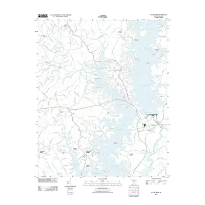
2011 Map of Old Pickens
USGS Topo · Published 2011About this map
The waters of Lake Keowee dominate this Oconee County landscape, where modern residential developments like Saxony Forest, Dogwood Heights, and White Harbor border the intricate shoreline. This modern survey reflects a region transformed by hydroelectric projects, specifically the South Carolina Noname 39017 Dam, which submerged portions of the historic Little River and Keowee River valleys. Despite the rise of the reservoir, numerous genealogical landmarks remain preserved, including Old Pickens Cemetery, Isaqueena Cemetery, and Wolf Stake Cemetery. Evidence of the older river-based economy can still be found in the names of river crossings and traditional landmarks, such as Robertsons Ford, Old Pickens Bridge, and Hunnicut Bridge. The map traces the winding paths of several tributaries, including Oconee Creek and Flat Shoals River, showing how contemporary road networks such as Oconee Creek RD and Nimmons Bridge RD navigate the many peninsulas and branches created by the reservoir's inundation.
Find a feature on this map
153 named features on this map. Tap any name to fly to it.
Don’t see what you’re looking for? This feature index may not catch every label — zoom into the map to look around manually.
Map Details
Editions of this 2011 Old Pickens Map
This is the sole edition of this map. No revisions or reprints were ever made.
Other maps of this area

1886 · Walhalla
USGS Topo · 1:125,000

1888 · Pickens
USGS Topo · 1:125,000

1892 · Walhalla
USGS Topo · 1:125,000

1894 · Pickens
USGS Topo · 1:125,000

1896 · Walhalla
USGS Topo · 1:125,000

1951 · Clemson
USGS Topo · 1:24,000

1954 · Greenville
USGS Topo · 1:250,000

1958 · Greenville
USGS Topo · 1:250,000

1958 · Seneca
USGS Topo · 1:24,000

1959 · Salem
USGS Topo · 1:24,000