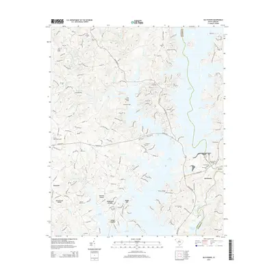
2014 Map of Old Pickens
USGS Topo · Published 2014About this map
Lake Keowee dominates the landscape of this Oconee County region, where the impounded waters of the Keowee River have fundamentally reshaped the geography. Along the irregular shoreline and the numerous peninsulas, residential developments like Saxony Forest, Dogwood Heights, and White Harbor illustrate the area's transition toward a lakeside community. The map preserves the location of older cultural sites, including the Old Pickens Cem and Craig Memorial Cem near the site of Old Pickens at the Big Bend of the river. Numerous family and community burial grounds such as Wolf Stake Cem, Isaqueena Cem, and Cary Cem remain scattered across the terrain, serving as vital markers for genealogists tracing local lineages. The presence of the Nest Farm Airport and several historic river crossings, including the Old Pickens Bridge and Flat Shoals Bridge, highlight the evolving transportation network of the Upstate.
Find a feature on this map
261 named features on this map. Tap any name to fly to it.
Don’t see what you’re looking for? This feature index may not catch every label — zoom into the map to look around manually.
Map Details
Editions of this 2014 Old Pickens Map
This is the sole edition of this map. No revisions or reprints were ever made.
Other maps of this area

1886 · Walhalla
USGS Topo · 1:125,000

1888 · Pickens
USGS Topo · 1:125,000

1892 · Walhalla
USGS Topo · 1:125,000

1894 · Pickens
USGS Topo · 1:125,000

1896 · Walhalla
USGS Topo · 1:125,000

1951 · Clemson
USGS Topo · 1:24,000

1954 · Greenville
USGS Topo · 1:250,000

1958 · Greenville
USGS Topo · 1:250,000

1958 · Seneca
USGS Topo · 1:24,000

1959 · Salem
USGS Topo · 1:24,000