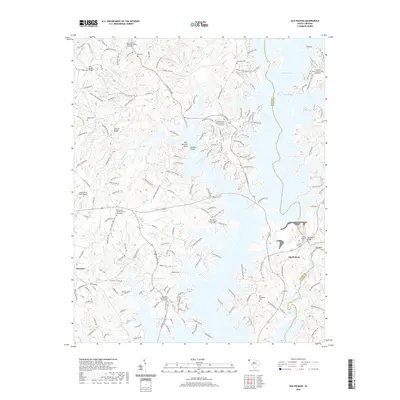
2020 Map of Old Pickens
USGS Topo · Published 2020About this map
Lake Keowee dominates this landscape along the border of Oconee and Pickens Counties, reflecting the transformation of the upper Savannah River basin. The area around Old Pickens remains a significant point of interest for local historians, featuring several dedicated burial sites such as the Old Pickens Cemetery and Craig Memorial Cemetery near the riverbanks. The settlement patterns are characterized by numerous rural churches and cemeteries, including the Wolf Stake Baptist Church and the Old New Hope Graveyard, which speak to the area's social fabric before and after the reservoir's creation. Geographers will note the distinct river bends like Big Bend and Fork Bottom Bend where the original course of the Keowee River still dictates the topography. Further inland, the map identifies local landmarks such as Ebenezer and the Hawks Nest Farm Airport, alongside evidence of historical community infrastructure like Keowee School Road.
Find a feature on this map
188 named features on this map. Tap any name to fly to it.
Don’t see what you’re looking for? This feature index may not catch every label — zoom into the map to look around manually.
Map Details
Editions of this 2020 Old Pickens Map
This is the sole edition of this map. No revisions or reprints were ever made.
Other maps of this area

1886 · Walhalla
USGS Topo · 1:125,000

1888 · Pickens
USGS Topo · 1:125,000

1892 · Walhalla
USGS Topo · 1:125,000

1894 · Pickens
USGS Topo · 1:125,000

1896 · Walhalla
USGS Topo · 1:125,000

1951 · Clemson
USGS Topo · 1:24,000

1954 · Greenville
USGS Topo · 1:250,000

1958 · Greenville
USGS Topo · 1:250,000

1958 · Seneca
USGS Topo · 1:24,000

1959 · Salem
USGS Topo · 1:24,000