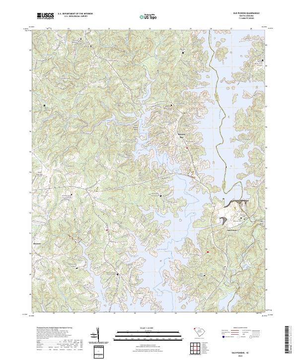
2024 Map of Old Pickens
USGS Topo · Published 2024About this map
Lake Keowee dominates the landscape of this contemporary survey, reflecting the transformation of the upper Savannah River basin where the Keowee River and Little River meet. At the center of the sheet, the historic site of Old Pickens sits near the river bend, marked by the Old Pickens Cem and Craig Memorial Cem. This area, once a bustling district seat, now serves as a window into the region's 19th-century history, preserved alongside modern developments like Keowee Key.
Find a feature on this map
190 named features on this map. Tap any name to fly to it.
Don’t see what you’re looking for? This feature index may not catch every label — zoom into the map to look around manually.
Map Details
Editions of this 2024 Old Pickens Map
This is the sole edition of this map. No revisions or reprints were ever made.
Other maps of this area

1886 · Walhalla
USGS Topo · 1:125,000

1888 · Pickens
USGS Topo · 1:125,000

1892 · Walhalla
USGS Topo · 1:125,000

1894 · Pickens
USGS Topo · 1:125,000

1896 · Walhalla
USGS Topo · 1:125,000

1951 · Clemson
USGS Topo · 1:24,000

1954 · Greenville
USGS Topo · 1:250,000

1958 · Greenville
USGS Topo · 1:250,000

1958 · Seneca
USGS Topo · 1:24,000

1959 · Salem
USGS Topo · 1:24,000