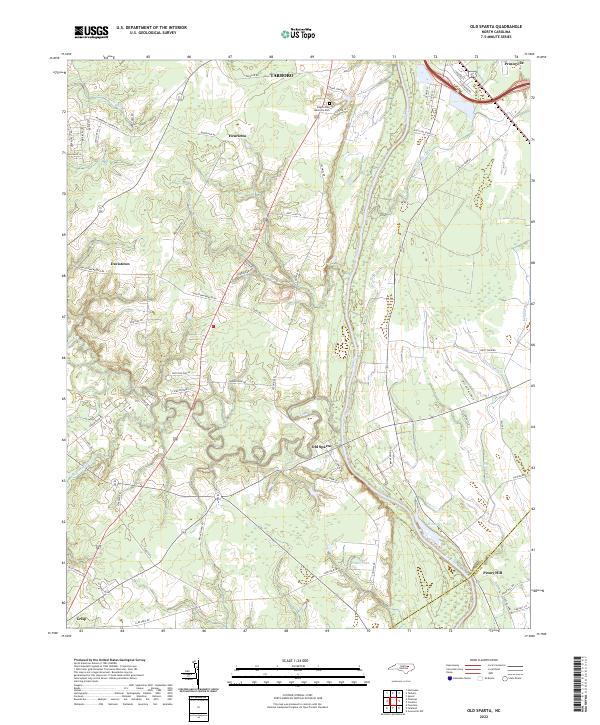
2022 Map of Old Sparta
USGS Topo · Published 2022About this map
The Tar River defines the landscape of southeastern Edgecombe County, winding past the historic river landing of Old Sparta and south toward the Edgecombe Co Pitt Co line. This 2022 survey illustrates a region where established settlements like Tarboro and Princeville are connected to rural crossroads such as Davistown, Henrietta, and Crisp through a dense network of farm-to-market roads. The flat coastal plain is heavily influenced by drainage engineering, evidenced by the Cromwell Canal and Knight Canal that help manage the low-lying terrain.
Find a feature on this map
62 named features on this map. Tap any name to fly to it.
Don’t see what you’re looking for? This feature index may not catch every label — zoom into the map to look around manually.
Map Details
Editions of this 2022 Old Sparta Map
This is the sole edition of this map. No revisions or reprints were ever made.
Other maps of this area

1901 · Parmele
USGS Topo · 1:62,500

1902 · Parmele
USGS Topo · 1:62,500

1902 · Tarboro
USGS Topo · 1:62,500

1903 · Tarboro
USGS Topo · 1:62,500

1903 · Winterville
USGS Topo · 1:62,500

1904 · Falkland
USGS Topo · 1:62,500

1905 · Winterville
USGS Topo · 1:62,500

1953 · Rocky Mount
USGS Topo · 1:250,000

1954 · Rocky Mount
USGS Topo · 1:250,000
1980 · Pinetops
USGS Topo · 1:24,000