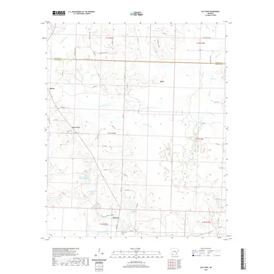
2020 Map of Old Town
USGS Topo · Published 2020About this map
Old Town and Piney Grove anchor the southern reaches of this landscape near the Hempstead and Lafayette County line. This 2020 survey documents a terrain defined by the winding paths of Little Bodcau Creek and its various tributaries like Tucker Branch and Thomas Branch. For genealogists and local historians, the map is particularly rich in family and community burial sites, including the Lewisville, Stricklin, Wilson, and Sewell cemeteries. The topography is further marked by managed water bodies such as New Meriwether Pond and Buehler Herndon Lake Number Two, reflecting modern land use and water management in the region. The network of county roads, such as County Road 25 and Hempstead 145 Road, provides a clear view of the rural infrastructure connecting smaller settlements like Midway and Baker.
Find a feature on this map
60 named features on this map. Tap any name to fly to it.
Don’t see what you’re looking for? This feature index may not catch every label — zoom into the map to look around manually.
Map Details
Editions of this 2020 Old Town Map
This is the sole edition of this map. No revisions or reprints were ever made.
Other maps of this area

1901 · Gurdon
USGS Topo · 1:125,000

1951 · Patmos
USGS Topo · 1:24,000

1951 · Spring Hill
USGS Topo · 1:24,000

1952 · Garland
USGS Topo · 1:24,000

1952 · Old Town
USGS Topo · 1:24,000

1952 · Lewisville
USGS Topo · 1:24,000

1952 · Boyd Hill
USGS Topo · 1:24,000

1953 · El Dorado
USGS Topo · 1:250,000

1957 · El Dorado
USGS Topo · 1:250,000

1958 · El Dorado
USGS Topo · 1:250,000