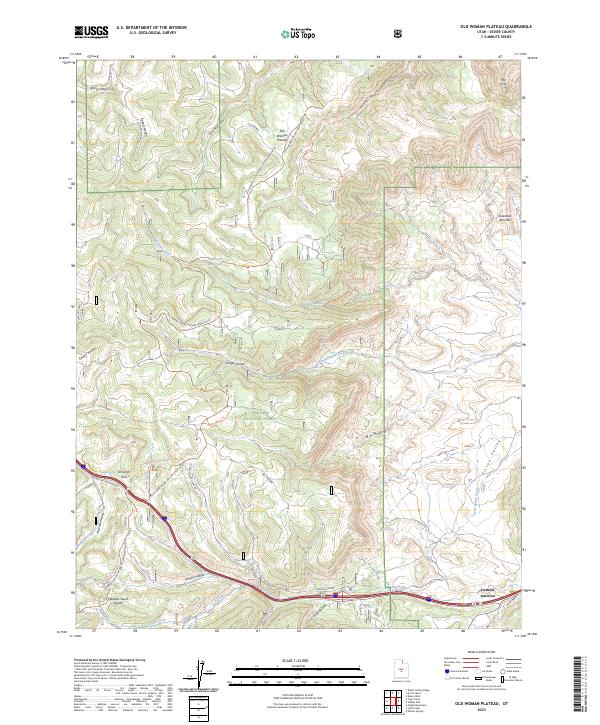
2023 Map of Old Woman Plateau
USGS Topo · Published 2023About this map
Old Woman Plateau and the surrounding high country dominate this high-altitude landscape within Fishlake National Forest. The map documents a complex system of drainage and canyon features, including the Saleratus Benches and the winding course of Saleratus Creek which feeds into the Saleratus Reservoir. Human infrastructure is concentrated primarily in the south at Fremont Junction, where modern transportation corridors intersect near the historic crossing at Emigrant Pass. The presence of Knight Mine Rd and Convulsion Rd hints at the region's industrial and resource extraction history. Significant elevation changes are marked by landmarks like Meadow Gulch Divide and the deep incisions of Tommy Hollow and Trough Hollow, illustrating the difficult passage through these central Utah highlands.
Find a feature on this map
44 named features on this map. Tap any name to fly to it.
Don’t see what you’re looking for? This feature index may not catch every label — zoom into the map to look around manually.
Map Details
Editions of this 2023 Old Woman Plateau Map
This is the sole edition of this map. No revisions or reprints were ever made.
Other maps of this area

1885 · Fish Lake
USGS Topo · 1:250,000

1896 · Fish Lake
USGS Topo · 1:250,000

1922 · Emery No.3
USGS Topo · 1:31,680

1925 · Acord Lakes
USGS Topo · 1:62,500

1956 · Salina
USGS Topo · 1:250,000

1960 · Salina
USGS Topo · 1:250,000

1962 · Salina
USGS Topo · 1:250,000
1966 · Water Hollow Ridge
USGS Topo · 1:24,000

1966 · Yogo Creek
USGS Topo · 1:24,000

1968 · Johns Peak
USGS Topo · 1:24,000