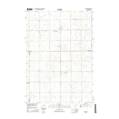
2015 Map of Oldham
USGS Topo · Published 2015About this map
Oldham sits atop the glacial upland of the Coteau des Prairies, a prominent geological feature that defines the drainage patterns of this eastern South Dakota landscape. This 2015 survey reveals a strictly organized section-line road network, where routes like 218th St and 445th Ave create a consistent grid across the rural terrain. The area is marked by numerous small depressions and seasonal wetlands characteristic of the coteau's topography. For genealogists and local historians, the map identifies key community anchors, including the Oldham Cem west of the settlement, Saint Andreas Cem to the northeast, and Toles Cem to the south. These sites, along with the convergence of Kingsbury, Lake, and Miner county boundaries, provide essential geographic context for tracing early family plots and land ownership in the region.
Find a feature on this map
25 named features on this map. Tap any name to fly to it.
Don’t see what you’re looking for? This feature index may not catch every label — zoom into the map to look around manually.
Map Details
Editions of this 2015 Oldham Map
This is the sole edition of this map. No revisions or reprints were ever made.
Other maps of this area

1953 · Watertown
USGS Topo · 1:250,000

1958 · Watertown
USGS Topo · 1:250,000

1968 · Oldham SW
USGS Topo · 1:24,000

1968 · Lake Preston East
USGS Topo · 1:24,000

1968 · Lake Preston West
USGS Topo · 1:24,000

1968 · Oldham NW
USGS Topo · 1:24,000

1968 · Arlington
USGS Topo · 1:24,000

1968 · Ramona
USGS Topo · 1:24,000

1968 · Oldham
USGS Topo · 1:24,000

1968 · Oldham SE
USGS Topo · 1:24,000