2021 Map of Oldham
USGS Topo · Published 2021About this map
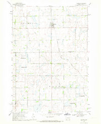
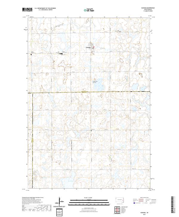
Oldham serves as the central hub of this agricultural landscape in eastern South Dakota, situated amidst the distinctive glacial topography of the Coteau des Prairies. This survey provides a precise account of the rural infrastructure at the start of the 2020s, dominated by a strict grid of county roads and avenues such as Co Hwy 10 and 445th Ave. The map is particularly notable for its density of burial sites, which offer significant genealogical value for the region. Clustered near the town site are several denominational cemeteries, including Saint Catherine's Cem, Oldham Lutheran Cem, and Trinity Lutheran Cem. Further out, the landscape is punctuated by numerous wetlands and small water bodies, with Davis Slough marking the low-lying terrain to the south near the Toles Cem.
Find a feature on this map
39 named features on this map. Tap any name to fly to it.
Don’t see what you’re looking for? This feature index may not catch every label — zoom into the map to look around manually.
Map Details
Editions of this 2021 Oldham Map
This is the sole edition of this map. No revisions or reprints were ever made.