
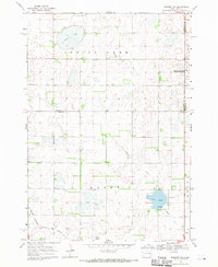
1968 Map of Oldham
USGS Topo · Published 1970About this map
Oldham serves as the central hub of this prairie landscape, situated near the intersection of the Chicago Milwaukee St Paul and Pacific railroad and local rural routes. The town is marked by its grid of streets and a local Townhall, while the surrounding countryside in Wayne township is dotted with markers of early settlement and community life. Significant water bodies like Whitewood Lake and Spring Lake dominate the northern terrain, interspersed with several National Wildlife Management Areas that indicate the region's commitment to conservation amidst agricultural land.
Find a feature on this map
17 named features on this map. Tap any name to fly to it.
Don’t see what you’re looking for? This feature index may not catch every label — zoom into the map to look around manually.
Map Details
Editions of this 1968 Oldham Map
This is the sole edition of this map. No revisions or reprints were ever made.
Other maps of this area

1953 · Watertown
USGS Topo · 1:250,000

1958 · Watertown
USGS Topo · 1:250,000

1968 · Oldham SW
USGS Topo · 1:24,000

1968 · Lake Preston East
USGS Topo · 1:24,000

1968 · Lake Preston West
USGS Topo · 1:24,000

1968 · Oldham NW
USGS Topo · 1:24,000

1968 · Arlington
USGS Topo · 1:24,000

1968 · Ramona
USGS Topo · 1:24,000

1968 · Oldham SE
USGS Topo · 1:24,000
1968 · Madison NW
USGS Topo · 1:24,000