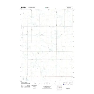
2012 Map of Oldham SE
USGS Topo · Published 2012About this map
Gilman Lake and the E Fork Vermillion River define this rural Lake County landscape, which is characterized by the distinctive prairie pothole hydrology of the region. The map reveals a network of wetlands and seasonal water bodies, including Davis Slough in the north and the expansive Hageman Slough to the west. This 2012 survey shows the area's agricultural grid of numbered roads, punctuated by small community landmarks that offer valuable insights for local historians and genealogists. In the southern portion of the quadrangle, the shoreline of Lake Winfred sits near the Winfred Cem, while the Saint Johns Lutheran Cem is located further north along 227th St. For those interested in local aviation or transport infrastructure, the Calico Field Airport is situated in the central portion of the sheet, providing a specific point of reference in this sparsely populated township.
Find a feature on this map
26 named features on this map. Tap any name to fly to it.
Don’t see what you’re looking for? This feature index may not catch every label — zoom into the map to look around manually.
Map Details
Editions of this 2012 Oldham SE Map
This is the sole edition of this map. No revisions or reprints were ever made.
Other maps of this area

1953 · Watertown
USGS Topo · 1:250,000

1955 · Sioux Falls
USGS Topo · 1:250,000

1958 · Sioux Falls
USGS Topo · 1:250,000

1958 · Watertown
USGS Topo · 1:250,000

1968 · Oldham SW
USGS Topo · 1:24,000

1968 · Oldham NW
USGS Topo · 1:24,000

1968 · Ramona
USGS Topo · 1:24,000

1968 · Lake Herman
USGS Topo · 1:24,000

1968 · Oldham
USGS Topo · 1:24,000

1968 · Oldham SE
USGS Topo · 1:24,000
Featured Places
- Wayne Township, SD
- Winfred Township, SD
- Belleview Township, SD
- Clearwater Township, SD
- Concord Township, SD