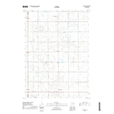
2017 Map of Oldham SE
USGS Topo · Published 2017About this map
Winfred sits at the southern edge of this prairie landscape, where the local road network of Main St and NW 2nd Ave meets S Dakota Highway 34. The topography is defined by the Coteau des Prairies, a high glacial plateau that creates a complex system of internal drainage. This is evident in the numerous water bodies dotting the township, including Gilman Lake, Lake Winfred, and marshy depressions like Crane Slough and Davis Slough. The E Fork Vermillion River provides a primary drainage corridor through the central and southern sections. For genealogists and local historians, the Saint John's Lutheran Cem stands as a significant landmark in the northern portion of the map, while Calico Field represents a named local clearing or landmark within this agricultural region of Lake County.
Find a feature on this map
41 named features on this map. Tap any name to fly to it.
Don’t see what you’re looking for? This feature index may not catch every label — zoom into the map to look around manually.
Map Details
Editions of this 2017 Oldham SE Map
This is the sole edition of this map. No revisions or reprints were ever made.
Other maps of this area

1953 · Watertown
USGS Topo · 1:250,000

1955 · Sioux Falls
USGS Topo · 1:250,000

1958 · Sioux Falls
USGS Topo · 1:250,000

1958 · Watertown
USGS Topo · 1:250,000

1968 · Oldham SW
USGS Topo · 1:24,000

1968 · Oldham NW
USGS Topo · 1:24,000

1968 · Ramona
USGS Topo · 1:24,000

1968 · Lake Herman
USGS Topo · 1:24,000

1968 · Oldham
USGS Topo · 1:24,000

1968 · Oldham SE
USGS Topo · 1:24,000
Featured Places
- Wayne Township, SD
- Winfred Township, SD
- Belleview Township, SD
- Clearwater Township, SD
- Concord Township, SD