
1968 Map of Oldham SE
USGS Topo · Published 1970About this map
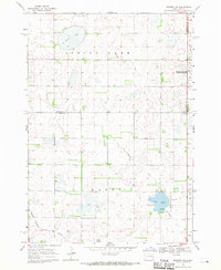
Winifred serves as the primary settlement on this 1968 landscape, situated at the southern edge of a glaciated prairie dotted with significant sloughs and seasonal wetlands. The agricultural and transport patterns of Lake County are well-defined here, with the C M St P & P railroad corridor running along the southern border near the Winifred corporate boundary. Family and community life are anchored by the St Johns Ch and the Winfred Cem, while the township's civic life is marked by the central Townhall.
Find a feature on this map
25 named features on this map. Tap any name to fly to it.
Don’t see what you’re looking for? This feature index may not catch every label — zoom into the map to look around manually.
Map Details
Editions of this 1968 Oldham SE Map
This is the sole edition of this map. No revisions or reprints were ever made.
Other maps of this area

1953 · Watertown
USGS Topo · 1:250,000

1955 · Sioux Falls
USGS Topo · 1:250,000

1958 · Sioux Falls
USGS Topo · 1:250,000

1958 · Watertown
USGS Topo · 1:250,000

1968 · Oldham SW
USGS Topo · 1:24,000

1968 · Oldham NW
USGS Topo · 1:24,000

1968 · Ramona
USGS Topo · 1:24,000

1968 · Lake Herman
USGS Topo · 1:24,000

1968 · Oldham
USGS Topo · 1:24,000
1968 · Madison NW
USGS Topo · 1:24,000
Featured Places
- Clearwater Township, SD
- Winfred Township, SD
- Wayne Township, SD
- Henden Township, SD
- Belleview Township, SD