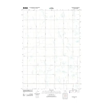
2012 Map of Oldham SW
USGS Topo · Published 2012About this map
Glacial depressions and seasonal wetlands define the prairie landscape of Adams Township in the early 21st century. The drainage pattern is anchored by the E Fork Vermillion River in the northeast and the Little Vermillion River to the south. Numerous named sloughs and lakes, such as McCart Slough, Wombacker Slough, and Otter Lake, dot the grid-patterned terrain, reflecting the high water table characteristic of this part of Miner County. The surveyor’s grid is strikingly regular here, with numbered roads like 225th St and 436th Ave marking the township lines and section boundaries. This 2012 record captures the area's agricultural layout, where the natural hydrology of features like The Horseshoe and Silver Lake still dictates the placement of fields and rural homesteads amidst the expansive South Dakota plains.
Find a feature on this map
24 named features on this map. Tap any name to fly to it.
Don’t see what you’re looking for? This feature index may not catch every label — zoom into the map to look around manually.
Map Details
Editions of this 2012 Oldham SW Map
This is the sole edition of this map. No revisions or reprints were ever made.
Other maps of this area

1899 · Alexandria
USGS Topo · 1:125,000

1899 · De Smet
USGS Topo · 1:125,000

1953 · Watertown
USGS Topo · 1:250,000

1955 · Sioux Falls
USGS Topo · 1:250,000

1958 · Sioux Falls
USGS Topo · 1:250,000

1958 · Watertown
USGS Topo · 1:250,000

1968 · Oldham SW
USGS Topo · 1:24,000

1968 · Oldham NW
USGS Topo · 1:24,000

1968 · Oldham
USGS Topo · 1:24,000

1968 · Oldham SE
USGS Topo · 1:24,000
Featured Places
- Adams Township, SD
- Belleview Township, SD
- Clearwater Township, SD
- Grafton Township, SD
- Henden Township, SD