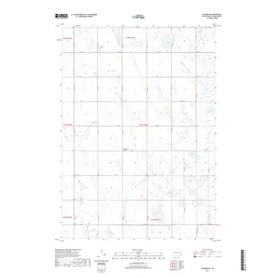
2017 Map of Oldham SW
USGS Topo · Published 2017About this map
The Coteau des Prairies plateau shapes this region of South Dakota, where the landscape is defined by its glacial heritage and numerous prairie potholes. In the northwestern corner, Belleview Cem stands as a focal point for genealogical research among the section lines of Adams Township. The area is characterized by an extensive network of wetlands and water bodies, including McCart Slough in the north and the larger Silver Lake and Otter Lake to the southeast. The drainage of the land is managed by the E Fork Vermillion River and the meandering Little Vermillion River, which passes through distinctive formations like The Horseshoe. This 2017 survey documents the modern layout of rural infrastructure, tracing the precise alignment of local thoroughfares such as Co HWY 8 and numerous numbered section roads.
Find a feature on this map
32 named features on this map. Tap any name to fly to it.
Don’t see what you’re looking for? This feature index may not catch every label — zoom into the map to look around manually.
Map Details
Editions of this 2017 Oldham SW Map
This is the sole edition of this map. No revisions or reprints were ever made.
Other maps of this area

1899 · Alexandria
USGS Topo · 1:125,000

1899 · De Smet
USGS Topo · 1:125,000

1953 · Watertown
USGS Topo · 1:250,000

1955 · Sioux Falls
USGS Topo · 1:250,000

1958 · Sioux Falls
USGS Topo · 1:250,000

1958 · Watertown
USGS Topo · 1:250,000

1968 · Oldham SW
USGS Topo · 1:24,000

1968 · Oldham NW
USGS Topo · 1:24,000

1968 · Oldham
USGS Topo · 1:24,000

1968 · Oldham SE
USGS Topo · 1:24,000
Featured Places
- Adams Township, SD
- Belleview Township, SD
- Clearwater Township, SD
- Grafton Township, SD
- Henden Township, SD