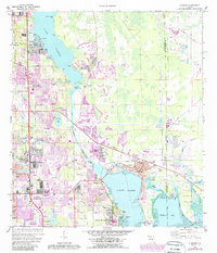
1974 Map of Oldsmar
USGS Topo · Published 1987About this map
Lake Tarpon and the northern reaches of Old Tampa Bay dominate this 1970s landscape, illustrating a period of significant suburban expansion in northern Pinellas County. The established community of Oldsmar is centered near the head of Safety Harbor, where the grid of Buckingham Ave and Arlington Ave meets the C S X railroad line. To the south, Safety Harbor is anchored by Philippe Park and the Espiritu Santo Ch, while the map also details the growing corridors of Clearwater and Dunedin. Cultural and recreational landmarks of the era are clearly visible, from the Florida Downs Racetrack in neighboring Hillsborough County to the Innisbrook golf course. Of particular interest to local historians is the Indian Mound at Philippe Pt, providing a physical link to the area's ancient past amidst the mid-century development shown by the extensive purple tint revisions.
Find a feature on this map
67 named features on this map. Tap any name to fly to it.
Don’t see what you’re looking for? This feature index may not catch every label — zoom into the map to look around manually.
Map Details
Editions of this 1974 Oldsmar Map
2 editions found
Other maps of this area

1921 · Sand Key
USGS Topo · 1:62,500

1921 · St Petersburg
USGS Topo · 1:62,500

1943 · Gandy Bridge
USGS Topo · 1:31,680

1943 · Safety Harbor
USGS Topo · 1:31,680

1943 · Dunedin
USGS Topo · 1:31,680

1943 · Tarpon Springs
USGS Topo · 1:31,680

1943 · Clearwater
USGS Topo · 1:24,000

1943 · Odessa
USGS Topo · 1:24,000

1943 · Elfers
USGS Topo · 1:24,000

1943 · Oldsmar
USGS Topo · 1:24,000