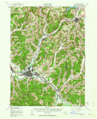
1938 Map of Olean
USGS Topo · Published 1964About this map
The Allegheny River and a dense network of competing rail lines define the industrial and agricultural landscape of Cattaraugus County in this 1938 revision. The city of Olean and its neighboring settlements like Boardmanville and East Olean are shown at a peak of rail connectivity, served by the Erie RR, the Pennsylvania RR, and the Pittsburg Shawmut & Northern RR. This infrastructure supported the local economy as it moved away from its lumbering roots toward manufacturing and transit.
Find a feature on this map
52 named features on this map. Tap any name to fly to it.
Don’t see what you’re looking for? This feature index may not catch every label — zoom into the map to look around manually.
Map Details
Editions of this 1938 Olean Map

Other maps of this area

1898 · Olean
USGS Topo · 1:62,500

1900 · Salamanca
USGS Topo · 1:62,500

1906 · Angelica
USGS Topo · 1:62,500

1924 · Ellicottville
USGS Topo · 1:62,500

1924 · Bradford
USGS Topo · 1:62,500

1924 · Franklinville
USGS Topo · 1:62,500

1925 · Belmont
USGS Topo · 1:62,500

1926 · Bradford
USGS Topo · 1:62,500

1933 · Smethport
USGS Topo · 1:62,500

1934 · Coudersport
USGS Topo · 1:48,000