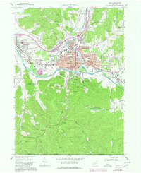
1961 Map of Olean
USGS Topo · Published 1980About this map
The Allegheny River defines the valley floor in this 1961 survey, where the industrial and educational centers of Olean and Allegany serve as the focal points for Cattaraugus County. The map documents a dense urban grid in neighborhoods like Boardmanville and North Olean, supported by a robust infrastructure of institutions including St Bonaventure University, St Marys Academy, and several numbered schools such as Sch No 10.
Find a feature on this map
116 named features on this map. Tap any name to fly to it.
Don’t see what you’re looking for? This feature index may not catch every label — zoom into the map to look around manually.
Map Details
Editions of this 1961 Olean Map
Other maps of this area

1898 · Olean
USGS Topo · 1:62,500

1900 · Salamanca
USGS Topo · 1:62,500

1924 · Bradford
USGS Topo · 1:62,500

1926 · Bradford
USGS Topo · 1:62,500

1933 · Smethport
USGS Topo · 1:62,500

1937 · Smethport
USGS Topo · 1:62,500

1938 · Salamanca
USGS Topo · 1:62,500

1938 · Olean
USGS Topo · 1:62,500

1941 · Bradford
USGS Topo · 1:62,500

1943 · Olean
USGS Topo · 1:62,500