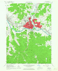
1961 Map of Olean
USGS Topo · Published 1967About this map
St Bonaventure University and the bustling neighborhoods of Olean anchor this mid-century portrait of the upper Allegheny River valley. The map reveals a dense network of neighborhoods including North Olean, South Olean, East Olean, and Boardmanville, all interconnected by the Erie-Lackawanna and Pennsylvania Railroad lines. This industrial and residential core is contrasted by the high ridges to the south, where Rock City Park and Hartzfelt Mtn overlook the sprawling Oil Field that historically defined the region's economy.
Find a feature on this map
121 named features on this map. Tap any name to fly to it.
Don’t see what you’re looking for? This feature index may not catch every label — zoom into the map to look around manually.
Map Details
Editions of this 1961 Olean Map
Other maps of this area

1898 · Olean
USGS Topo · 1:62,500

1900 · Salamanca
USGS Topo · 1:62,500

1924 · Bradford
USGS Topo · 1:62,500

1926 · Bradford
USGS Topo · 1:62,500

1933 · Smethport
USGS Topo · 1:62,500

1937 · Smethport
USGS Topo · 1:62,500

1938 · Salamanca
USGS Topo · 1:62,500

1938 · Olean
USGS Topo · 1:62,500

1941 · Bradford
USGS Topo · 1:62,500

1943 · Olean
USGS Topo · 1:62,500