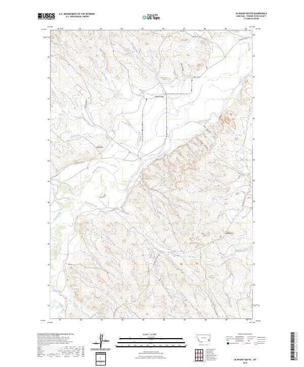
2024 Map of Oliphant Butte
USGS Topo · Published 2024About this map
The Powder River carves a winding path through this corner of Powder River County, Montana, defining a landscape of complex drainages and high points. Prominent landmarks such as Oliphant Butte and Tepee Hill rise above the surrounding terrain, serving as vital navigational markers in an area characterized by its network of seasonal coulees and gulches. The drainage pattern is intricate, with Mushroom Creek, Slaughter Creek, and the North Fork Hay Creek all feeding toward the central river valley.
Find a feature on this map
28 named features on this map. Tap any name to fly to it.
Don’t see what you’re looking for? This feature index may not catch every label — zoom into the map to look around manually.
Map Details
Editions of this 2024 Oliphant Butte Map
This is the sole edition of this map. No revisions or reprints were ever made.
Other maps of this area

1954 · Ekalaka
USGS Topo · 1:250,000

1956 · Ekalaka
USGS Topo · 1:250,000

1958 · Ekalaka
USGS Topo · 1:250,000

1965 · Ekalaka
USGS Topo · 1:250,000

1973 · Cross S School
USGS Topo · 1:24,000
1973 · Rattlesnake Hill
USGS Topo · 1:24,000

1973 · Hawkey Creek
USGS Topo · 1:24,000

1979 · Deer Creek Buttes
USGS Topo · 1:24,000

1979 · Powderville
USGS Topo · 1:24,000

1979 · Rattlesnake Ridge
USGS Topo · 1:24,000