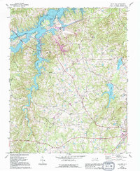
1968 Map of Olive Hill
USGS Topo · Published 1994About this map
Hyco Lake dominates the northwest quadrant of this Person County landscape, its sprawling shoreline created by the impoundment of the Hyco River and tributaries like South Hyco Creek. The presence of a large Powerplant and multiple electrical substations indicates the industrial importance of the reservoir during the late 1960s. Rural life is anchored by small communities such as Ceffo, Concord, and Olive Hill, alongside landmarks like Woodland Sch and the Lamberth Memorial Ch Cem. To the southeast, the terrain transitions toward the outskirts of Roxboro, where Roxboro Lake and Chub Lake provide further water resources. This survey captures a moment when traditional crossroads like Longs Store and Five Forks persisted even as modern infrastructure and utilities were reshaping the rural character of the region.
Find a feature on this map
47 named features on this map. Tap any name to fly to it.
Don’t see what you’re looking for? This feature index may not catch every label — zoom into the map to look around manually.
Map Details
Editions of this 1968 Olive Hill Map
This is the sole edition of this map. No revisions or reprints were ever made.
Other maps of this area

1943 · Roxboro
USGS Topo · 1:62,500

1952 · Milton
USGS Topo · 1:62,500

1953 · South Boston
USGS Topo · 1:62,500

1953 · Greensboro
USGS Topo · 1:250,000

1954 · Greensboro
USGS Topo · 1:250,000

1956 · Milton
USGS Topo · 1:62,500

1957 · South Boston
USGS Topo · 1:62,500

1962 · Greensboro
USGS Topo · 1:250,000

1966 · Greensboro
USGS Topo · 1:250,000

1968 · Leasburg
USGS Topo · 1:24,000