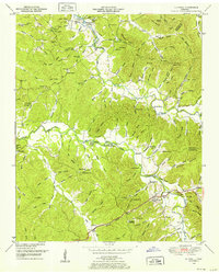
1949 Map of Olivehill
USGS Topo · Published 1952About this map
Olivehill and the winding course of Hardin Creek anchor this late 1940s study of the Hardin and Wayne County borderlands. The landscape is defined by a dense network of hollows—such as Boneyard Hollow, Paradise Hollow, and Mash Hollow—that drain into larger watercourses like Indian Creek. Significant for local historians is the documentation of river-reliant infrastructure, including numerous river crossings such as Porter Ford, Garrard Ford, and Whitten Ford.
Find a feature on this map
145 named features on this map. Tap any name to fly to it.
Don’t see what you’re looking for? This feature index may not catch every label — zoom into the map to look around manually.
Map Details
Editions of this 1949 Olivehill Map
3 editions found
Other maps of this area

1905 · Waynesboro
USGS Topo · 1:125,000

1936 · Savannah
USGS Topo · 1:24,000

1936 · Wolf Pit Ridge
USGS Topo · 1:24,000

1936 · Hookers Bend
USGS Topo · 1:24,000

1936 · Eagle Creek
USGS Topo · 1:24,000

1936 · Thurman
USGS Topo · 1:24,000

1936 · Olivehill
USGS Topo · 1:24,000

1936 · Bath Springs
USGS Topo · 1:24,000

1936 · Clifton
USGS Topo · 1:24,000

1936 · Martins Mills
USGS Topo · 1:24,000