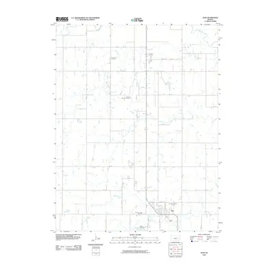
2010 Map of Olpe
USGS Topo · Published 2010About this map
The settlement of Olpe serves as the primary hub in this Kansas landscape, situated south of the sweeping Cottonwood River. This 2010 survey illustrates a region defined by a grid of rural thoroughfares, including Rd 80 and Rd 85, which structure the agricultural and residential life of Lyon County. The land is characterized by the natural drainage of the river basin, which dictates the layout of local roads and the placement of the town itself. While the area maintains its rural character, the proximity to the river suggests the importance of water resources to the regional development and long-term settlement patterns of this part of the Flint Hills region.
Find a feature on this map
4 named features on this map. Tap any name to fly to it.
Don’t see what you’re looking for? This feature index may not catch every label — zoom into the map to look around manually.
Map Details
Editions of this 2010 Olpe Map
This is the sole edition of this map. No revisions or reprints were ever made.
Other maps of this area

1888 · Emporia
USGS Topo · 1:125,000

1894 · Emporia
USGS Topo · 1:125,000

1955 · Hutchinson
USGS Topo · 1:250,000

1957 · Lang
USGS Topo · 1:24,000

1957 · Emporia
USGS Topo · 1:24,000

1957 · Plymouth
USGS Topo · 1:24,000

1959 · Hutchinson
USGS Topo · 1:250,000
1973 · Olpe
USGS Topo · 1:24,000

1973 · Shaw Creek
USGS Topo · 1:24,000
1973 · Phenis Creek
USGS Topo · 1:24,000