2022 Map of Olpe
USGS Topo · Published 2022About this map
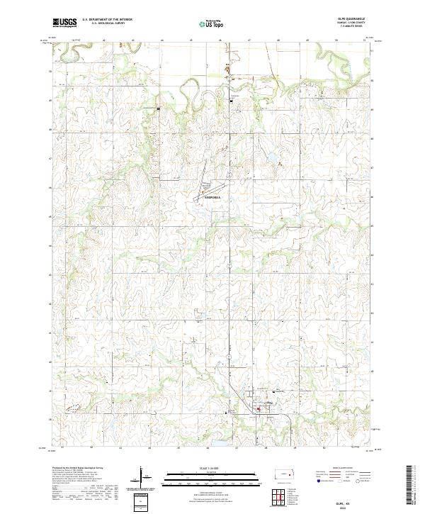
Olpe serves as the primary southern anchor for this portion of Lyon County, situated within a landscape defined by the drainage basins of Cottonwood River and Dry Cr. The map details a transition from the industrial and transportation infrastructure of the Emporia outskirts to the traditional agricultural grid. Local heritage is preserved through a series of rural burying grounds, including Greenwood Cem in the north and Saint Joseph Cem near the heart of the settlement. The Emporia Municipal Airport occupies a central position, highlighting the area's role in regional aviation connectivity. Watercourses like Coal Cr and Eagle Cr carve subtle variations into the terrain, while a meticulous network of section roads, such as RD 110 and RD 70, illustrates the enduring organization of the Kansas prairie.
Find a feature on this map
35 named features on this map. Tap any name to fly to it.
Don’t see what you’re looking for? This feature index may not catch every label — zoom into the map to look around manually.
Map Details
Editions of this 2022 Olpe Map
This is the sole edition of this map. No revisions or reprints were ever made.
Historical Maps of Emporia Through Time
2 maps found