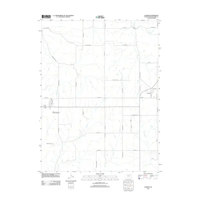
2012 Map of Olsburg
USGS Topo · Published 2012About this map
Olsburg and Fostoria anchor this Kansas landscape, reflecting the rural settlement patterns of Pottawatomie County during the early 21st century. The map reveals a deeply etched drainage network dominated by Carnahan Cr and the Shannon River, with numerous smaller tributaries like Bucksnort Cr and Spring Cr carving through the terrain. A grid of section roads, including Swede Rd and Bigelow Rd, organizes the agricultural land, while more specialized infrastructure such as the Laflin Ranch Airport and the Olsburg Wastewater Treatment Facility indicate the area's modern utility.
Find a feature on this map
50 named features on this map. Tap any name to fly to it.
Don’t see what you’re looking for? This feature index may not catch every label — zoom into the map to look around manually.
Map Details
Editions of this 2012 Olsburg Map
This is the sole edition of this map. No revisions or reprints were ever made.
Other maps of this area

1886 · Junction City
USGS Topo · 1:125,000

1889 · Seneca
USGS Topo · 1:125,000

1889 · Wamego
USGS Topo · 1:125,000

1889 · Marysville
USGS Topo · 1:125,000

1889 · Junction City
USGS Topo · 1:125,000

1894 · Junction City
USGS Topo · 1:125,000

1894 · Seneca
USGS Topo · 1:125,000

1894 · Marysville
USGS Topo · 1:125,000

1894 · Wamego
USGS Topo · 1:125,000

1955 · Manhattan
USGS Topo · 1:250,000