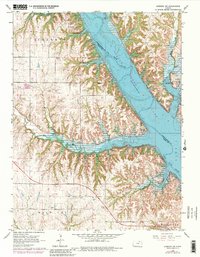
1964 Map of Olsburg SW
USGS Topo · Published 1984About this map
The Big Blue River dominates this mid-century landscape of Riley County, following the completion of the dam that created Tuttle Creek Lake. The map captures the transitional character of the region as former valley land was inundated for flood control, leaving behind recreation hubs like the Stockdale Recreation Area and Garrison Recreation Area. This shift from agriculture to reservoir-based management is reflected in the surrounding hills, where township lines for Sherman, Green, and Grant meet across the water.
Find a feature on this map
27 named features on this map. Tap any name to fly to it.
Don’t see what you’re looking for? This feature index may not catch every label — zoom into the map to look around manually.
Map Details
Editions of this 1964 Olsburg SW Map
3 editions found
Other maps of this area

1886 · Junction City
USGS Topo · 1:125,000

1889 · Junction City
USGS Topo · 1:125,000

1894 · Junction City
USGS Topo · 1:125,000

1947 · Manhattan
USGS Topo · 1:62,500

1947 · Fort Riley
USGS Topo · 1:62,500

1950 · Keats
USGS Topo · 1:24,000

1950 · Manhattan
USGS Topo · 1:24,000

1951 · Wind Creek
USGS Topo · 1:24,000

1955 · Fort Riley NE
USGS Topo · 1:24,000
1955 · Manhattan
USGS Topo · 1:24,000