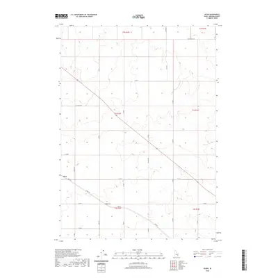
2020 Map of Olsen
USGS Topo · Published 2020About this map
Olsen and the nearby settlement of Havens anchor this rural landscape in Bingham County during the early 21st century. The map reveals a strictly organized grid of agricultural and local access roads, with Taber Rd and W Taber Rd providing the primary diagonal transit through the territory. The terrain is characterized by subtle elevation shifts and intermittent drainage patterns typical of this portion of Idaho. Local landmarks such as Baldy Knoll Loop and Hilltop Rd suggest the modest topographic rises that punctuate the otherwise level township and range system. This survey documents the intersection of several townships, including t1s r33e and t2s r33e, tracing the modern road network that connects family farmsteads and rural dwellings via routes like Vincent Rd and Rhead Rd.
Find a feature on this map
29 named features on this map. Tap any name to fly to it.
Don’t see what you’re looking for? This feature index may not catch every label — zoom into the map to look around manually.
Map Details
Editions of this 2020 Olsen Map
This is the sole edition of this map. No revisions or reprints were ever made.
Other maps of this area

1940 · Blackfoot
USGS Topo · 1:62,500

1943 · Blackfoot
USGS Topo · 1:62,500

1955 · Springfield NW
USGS Topo · 1:24,000

1955 · Baldy Knoll
USGS Topo · 1:24,000

1955 · Rockford
USGS Topo · 1:24,000

1955 · Idaho Falls
USGS Topo · 1:250,000

1958 · Idaho Falls
USGS Topo · 1:250,000
1971 · Moreland
USGS Topo · 1:24,000

1973 · Olsen
USGS Topo · 1:24,000

1973 · Middle Butte
USGS Topo · 1:24,000