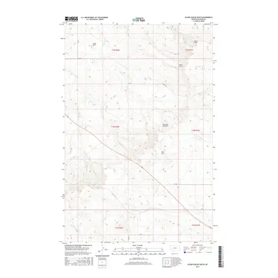
2017 Map of Olson Coulee South
USGS Topo · Published 2017About this map
The Big Sheep Mountains dominate this central section of Dawson County, characterized by a complex network of coulees and seasonal drainages. Notable peaks such as Crazy Butte and High Point anchor the high ground between the various watercourses that carve through the landscape. The drainage pattern is well-defined by Sioux Cr, Cottonwood Cr, and Hay Cr, illustrating the watershed's significance for local land use. While major settlements are absent, the map reveals the essential infrastructure of rural Montana through routes like RD 401 and the Pasture Trl. These tracks, along with features like Stilson Coulee and Olson Coulee, provide a clear picture of the vast grazing lands and the practical geography required for navigating this portion of the northern plains.
Find a feature on this map
24 named features on this map. Tap any name to fly to it.
Don’t see what you’re looking for? This feature index may not catch every label — zoom into the map to look around manually.
Map Details
Editions of this 2017 Olson Coulee South Map
This is the sole edition of this map. No revisions or reprints were ever made.
Other maps of this area

1954 · Glendive
USGS Topo · 1:250,000

1957 · Glendive
USGS Topo · 1:250,000

1958 · Glendive
USGS Topo · 1:250,000
1982 · Circle
USGS Topo · 1:100,000
1983 · Johnson Reservoir NW
USGS Topo · 1:24,000
1983 · Union School
USGS Topo · 1:24,000
1983 · Woodworth Hill
USGS Topo · 1:24,000
1983 · Olson Coulee South
USGS Topo · 1:24,000
1983 · Mount Antelope
USGS Topo · 1:24,000
1983 · Deer Creek Church
USGS Topo · 1:24,000