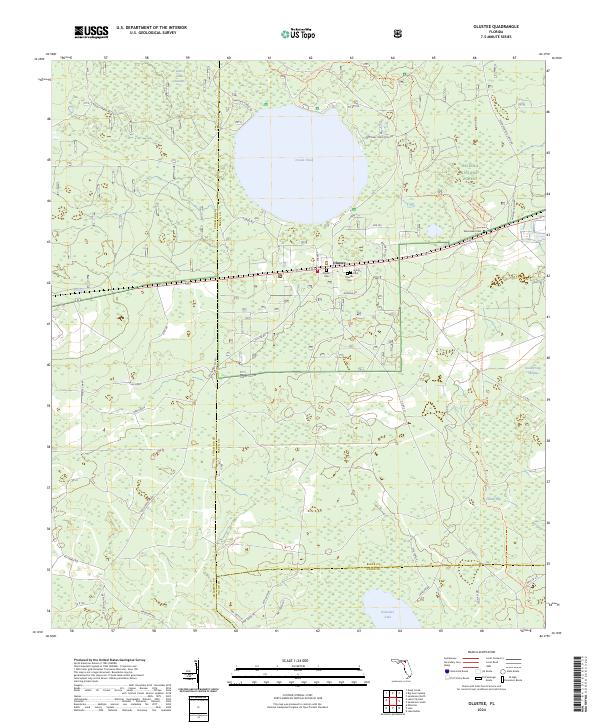
2024 Map of Olustee
USGS Topo · Published 2024About this map
Osceola National Forest dominates this landscape in Baker County, defined by its extensive wetlands and the prominent circular expanse of Ocean Pond. The settlement of Olustee serves as a central point for local history, situated near several significant burial sites including Olustee Cem, Dyess Cem, and Arline Cem. Cultural and recreational heritage is evident through the path of the Florida National Scenic Trl and the Olustee Battlefield Trl, the latter of which leads toward the Monument Cem area. The geography is further marked by low-lying basins like Little Gum Swamp, South Long Swamp, and Holder Bay. To the south, the terrain transitions toward Palestine Lake at the border of Union County, showing a network of forest roads and local tracks like Mt Carrie Rd and Clay Hole that crisscross the pine flatwoods.
Find a feature on this map
43 named features on this map. Tap any name to fly to it.
Don’t see what you’re looking for? This feature index may not catch every label — zoom into the map to look around manually.
Map Details
Editions of this 2024 Olustee Map
This is the sole edition of this map. No revisions or reprints were ever made.
Other maps of this area

1954 · Valdosta
USGS Topo · 1:250,000

1958 · Valdosta
USGS Topo · 1:250,000

1959 · Valdosta
USGS Topo · 1:250,000

1961 · Deep Creek
USGS Topo · 1:24,000

1962 · Lake City East
USGS Topo · 1:24,000

1963 · Olustee
USGS Topo · 1:24,000

1963 · Sanderson South
USGS Topo · 1:24,000

1963 · Ellisville
USGS Topo · 1:24,000

1966 · Lake Butler
USGS Topo · 1:24,000
1966 · Lulu
USGS Topo · 1:24,000