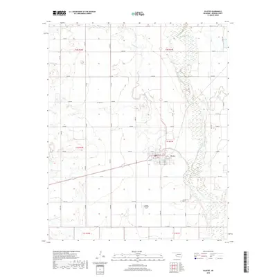
2018 Map of Olustee
USGS Topo · Published 2018About this map
Olustee serves as the central hub for this Jackson County landscape, situated where the high plains meet the intricate wetlands of the Salt Fork Red River. The settlement's residential grid is clearly defined, with streets like W 2nd St and E 9th St framing the town's core. Outside the village, the landscape is divided by a rigorous section-line road system, including E1700 Rd and N1980 Rd, which provide access to the surrounding agricultural lands and the Olustee Municipal Airport. Genealogy researchers will find notable landmarks in the Aaron Cem to the northwest and Olustee Cem to the southeast, both positioned near the winding paths of Turkey Creek and its various tributaries. The eastern edge of the map is dominated by the broad, braided floodplain of the river, where ephemeral streams like Bitter Cr feed into the wider basin.
Find a feature on this map
44 named features on this map. Tap any name to fly to it.
Don’t see what you’re looking for? This feature index may not catch every label — zoom into the map to look around manually.
Map Details
Editions of this 2018 Olustee Map
This is the sole edition of this map. No revisions or reprints were ever made.
Other maps of this area

1955 · Lawton
USGS Topo · 1:250,000

1958 · Elmer
USGS Topo · 1:62,500

1960 · Quanah
USGS Topo · 1:62,500

1963 · Altus SE
USGS Topo · 1:24,000

1964 · Martha
USGS Topo · 1:24,000

1964 · Altus
USGS Topo · 1:24,000

1964 · Olustee
USGS Topo · 1:24,000

1971 · Duke
USGS Topo · 1:24,000

1971 · Prairie Hill
USGS Topo · 1:24,000

1975 · Elmore City NE
USGS Topo · 1:24,000