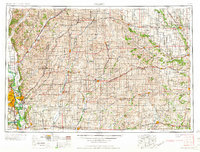
1958 Map of Omaha
USGS Topo · Published 1958About this map
The Missouri River valley and its surrounding bluffs dominate this mid-century landscape, anchoring the major urban hubs of Omaha and Council Bluffs. This era depicts a critical juncture in Midwestern transportation history, showing the development of Interstate 80 alongside an extensive rail network that includes the Chicago Burlington and Quincy RR and the Chicago and North Western RR. These lines connect agricultural centers like Red Oak, Atlantic, and Creston to the river markets.
Find a feature on this map
107 named features on this map. Tap any name to fly to it.
Don’t see what you’re looking for? This feature index may not catch every label — zoom into the map to look around manually.
Map Details
Editions of this 1958 Omaha Map
2 editions found

Other maps of this area

1893 · Omaha
USGS Topo · 1:62,500

1893 · Fremont
USGS Topo · 1:125,000

1896 · Fremont
USGS Topo · 1:125,000

1903 · Weeping Water
USGS Topo · 1:125,000

1908 · Waukee
USGS Topo · 1:62,500

1911 · Madrid
USGS Topo · 1:62,500

1914 · Madrid
USGS Topo · 1:62,500

1916 · Boone
USGS Topo · 1:62,500

1929 · Weeping Water
USGS Topo · 1:125,000

1935 · Nehawka
USGS Topo · 1:48,000