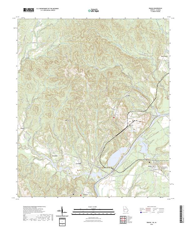
2024 Map of Omaha
USGS Topo · Published 2024About this map
The Chattahoochee River carves the border between Stewart County, Georgia, and Russell County, Alabama, anchoring a landscape defined by its riparian valleys and agricultural settlements. This modern survey illustrates the historic community of Omaha on the Georgia side, where researchers can locate the Omaha Baptist Church Cem and the Saint Paul African Methodist Episcopal Church Cem. The terrain is deeply etched by a complex drainage network including Hatchechubbee Creek and Hannahatchee Creek, which feed into the river's main channel.
Find a feature on this map
61 named features on this map. Tap any name to fly to it.
Don’t see what you’re looking for? This feature index may not catch every label — zoom into the map to look around manually.
Map Details
Editions of this 2024 Omaha Map
This is the sole edition of this map. No revisions or reprints were ever made.
Other maps of this area

1908 · Columbus
USGS Topo · 1:62,500

1914 · Seale
USGS Topo · 1:62,500

1929 · Columbus
USGS Topo · 1:48,000

1947 · Columbus
USGS Topo · 1:62,500

1949 · Fort Mitchell
USGS Topo · 1:24,000

1949 · Julia
USGS Topo · 1:24,000

1950 · Fort Benning
USGS Topo · 1:24,000

1950 · Seale
USGS Topo · 1:24,000

1950 · Lumpkin SW
USGS Topo · 1:24,000

1950 · Seale
USGS Topo · 1:62,500