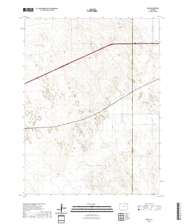
2022 Map of Omar
USGS Topo · Published 2022About this map
Weld County and Morgan County meet along a sharp North-South boundary in this high plains landscape, where the ephemeral drainage of Kiowa Cr winds through a terrain of low ridges and agricultural sections. The map reveals a land defined by its water management and county road grid, notably featuring the West Nile Reservoir in the southeastern quadrant. This area, dominated by large-scale ranching or farming divisions, is bisected by the heavy line of Interstate 76 and its accompanying Frontage Rd, which provide the primary transit corridor through these open reaches. Smaller named waterways like Jack Rabbit Cr and Rock Cr cut across the southern sections, illustrating the natural hydrological patterns that influence the placement of the rural road network, including Co Rd 1 and Co Rd 91.
Find a feature on this map
19 named features on this map. Tap any name to fly to it.
Don’t see what you’re looking for? This feature index may not catch every label — zoom into the map to look around manually.
Map Details
Editions of this 2022 Omar Map
This is the sole edition of this map. No revisions or reprints were ever made.
Other maps of this area

1950 · Wiggins
USGS Topo · 1:24,000

1950 · South Roggen
USGS Topo · 1:24,000

1950 · Wiggins SW
USGS Topo · 1:24,000

1950 · Masters
USGS Topo · 1:24,000

1950 · Hoyt
USGS Topo · 1:24,000

1951 · Hoyt
USGS Topo · 1:24,000

1951 · Masters
USGS Topo · 1:24,000

1951 · Orchard
USGS Topo · 1:24,000

1951 · Roggen
USGS Topo · 1:24,000

1951 · Omar
USGS Topo · 1:24,000