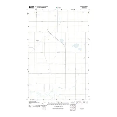
2011 Map of Omemee
USGS Topo · Published 2011About this map
Omemee sits at the heart of this agricultural landscape in Bottineau County, where the geometric grid of the rural township system remains the defining feature of the terrain. The map captures a moment in the early 21st century, illustrating a network of well-defined section roads such as 16th Ave NE and 92nd St NE that connect small local hubs. Notable among these are the settlements of Tasco and Belmar, which serve as markers of the area's long-term habitation. The southern portion of the quadrangle is marked by the meandering paths of Willow Creek and Miller Creek, which provide natural relief to the otherwise rigid section lines. Genealogists and local historians will find the Tasco Cemetery particularly valuable, as it stands as a permanent record of the families who settled this prairie region.
Find a feature on this map
21 named features on this map. Tap any name to fly to it.
Don’t see what you’re looking for? This feature index may not catch every label — zoom into the map to look around manually.
Map Details
Editions of this 2011 Omemee Map
This is the sole edition of this map. No revisions or reprints were ever made.
Other maps of this area

1935 · Dunseith
USGS Topo · 1:48,000

1939 · Dunseith
USGS Topo · 1:62,500

1950 · Willow City SW
USGS Topo · 1:24,000

1954 · Omemee
USGS Topo · 1:24,000

1954 · Barton
USGS Topo · 1:24,000

1954 · Gardena
USGS Topo · 1:24,000

1954 · Willow City
USGS Topo · 1:24,000

1954 · Minot
USGS Topo · 1:250,000

1955 · Lords Lake
USGS Topo · 1:24,000

1955 · Overly
USGS Topo · 1:24,000