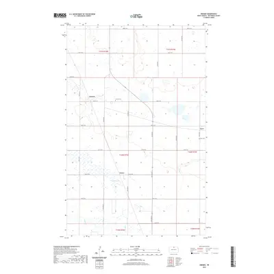
2020 Map of Omemee
USGS Topo · Published 2020About this map
Omemee and the surrounding agricultural lands of Bottineau County are defined by a grid of section-line roads and the scattered remains of early North Dakota rail-side settlements. This landscape in the 2020s preserves the footprint of several small communities, most notably Belmar and Tasco, alongside their respective local landmarks. The Omemee Cem and Tasco Cem serve as critical points of reference for genealogists tracing families from this corner of the prairie. The natural geography is characterized by low-lying wetlands and seasonal watercourses, including the Belmar Slough and the winding paths of Miller Cr and Willow Cr. These features, alongside the meticulous survey of townships like T160N R75W, reveal the enduring patterns of rural land division and drainage that have shaped life in the region for over a century.
Find a feature on this map
29 named features on this map. Tap any name to fly to it.
Don’t see what you’re looking for? This feature index may not catch every label — zoom into the map to look around manually.
Map Details
Editions of this 2020 Omemee Map
This is the sole edition of this map. No revisions or reprints were ever made.
Other maps of this area

1935 · Dunseith
USGS Topo · 1:48,000

1939 · Dunseith
USGS Topo · 1:62,500

1950 · Willow City SW
USGS Topo · 1:24,000

1954 · Omemee
USGS Topo · 1:24,000

1954 · Barton
USGS Topo · 1:24,000

1954 · Gardena
USGS Topo · 1:24,000

1954 · Willow City
USGS Topo · 1:24,000

1954 · Minot
USGS Topo · 1:250,000

1955 · Lords Lake
USGS Topo · 1:24,000

1955 · Overly
USGS Topo · 1:24,000