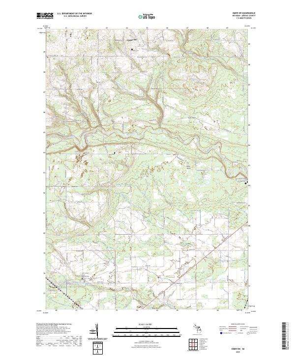
2023 Map of Omer SW
USGS Topo · Published 2023About this map
The Rifle River winds through this section of Arenac County, defining a landscape where agricultural plains meet a complex network of waterways. The settlement patterns of Omer Plains and Tyler Plains are centered on these fertile stretches, while the northern reaches are dominated by the small community of Knights Mill. This 2023 map provides a clear look at the enduring presence of local heritage sites, particularly the numerous rural burial grounds that anchor the landscape.
Find a feature on this map
74 named features on this map. Tap any name to fly to it.
Don’t see what you’re looking for? This feature index may not catch every label — zoom into the map to look around manually.
Map Details
Editions of this 2023 Omer SW Map
This is the sole edition of this map. No revisions or reprints were ever made.
Other maps of this area

1954 · Traverse City
USGS Topo · 1:250,000

1954 · Midland
USGS Topo · 1:250,000

1954 · Flint
USGS Topo · 1:250,000

1954 · Tawas City
USGS Topo · 1:250,000

1958 · Traverse City
USGS Topo · 1:250,000

1958 · Flint
USGS Topo · 1:250,000

1958 · Tawas City
USGS Topo · 1:250,000

1958 · Midland
USGS Topo · 1:250,000

1959 · Midland
USGS Topo · 1:250,000

1966 · Midland
USGS Topo · 1:250,000