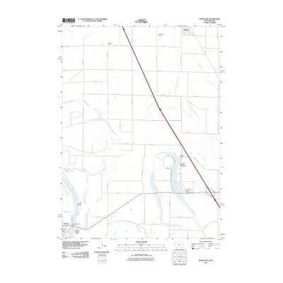
2010 Map of Onawa SW
USGS Topo · Published 2010About this map
Blue Lake sits as a prominent oxbow remnant within this 2010 landscape, illustrating the dynamic history of the Missouri River along the Iowa-Nebraska border. The river's winding course is marked by significant features like Tieville Bend and Middle Decatur Bend, while the Burt County Toll Bridge provides a vital interstate connection to the settlement of Decatur. This crossing point is a focal point for the region, adjacent to the Decatur Post Office.
Find a feature on this map
45 named features on this map. Tap any name to fly to it.
Don’t see what you’re looking for? This feature index may not catch every label — zoom into the map to look around manually.
Map Details
Editions of this 2010 Onawa SW Map
This is the sole edition of this map. No revisions or reprints were ever made.
Other maps of this area

1955 · Sioux City
USGS Topo · 1:250,000

1955 · Fremont
USGS Topo · 1:250,000

1957 · Fremont
USGS Topo · 1:250,000

1958 · Sioux City
USGS Topo · 1:250,000

1958 · Fremont
USGS Topo · 1:250,000

1959 · Sioux City
USGS Topo · 1:250,000

1966 · Macy
USGS Topo · 1:24,000

1969 · Onawa
USGS Topo · 1:24,000

1969 · Albaton
USGS Topo · 1:24,000
1969 · Hornick
USGS Topo · 1:24,000