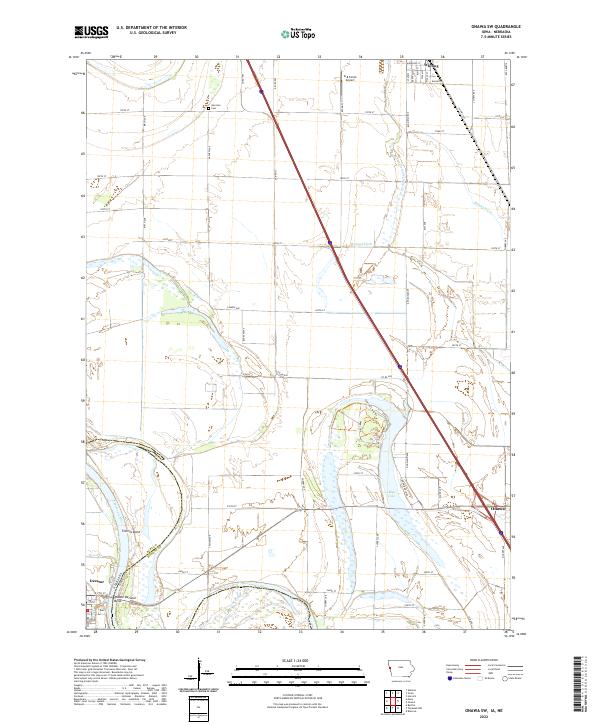
2022 Map of Onawa SW
USGS Topo · Published 2022About this map
The Missouri River defines the western edge of this landscape along the border of Iowa and Nebraska, carving distinct features like Tieville Bend and Middle Decatur Bend into the floodplains. The interior geography is marked by an extensive network of drainage channels, including the McCandless Cleghorn Ditch, Myrland Ditch, and Murphy Ditch, which support the agricultural tracts between the settlements of Whiting and Onawa. Near the river, Blue Lake sits as a significant water body, with the Lewis & Clark Tr winding through the area, reflecting the region's importance as a historical corridor. For genealogists, the Harrison Cem remains a localized point of interest north of the river's curves. The presence of Decatur across the state line and the dense grid of rural roads like Birch Ave and Cashew Ave illustrate the modern settlement patterns established over generations of riverfront habitation.
Find a feature on this map
61 named features on this map. Tap any name to fly to it.
Don’t see what you’re looking for? This feature index may not catch every label — zoom into the map to look around manually.
Map Details
Editions of this 2022 Onawa SW Map
This is the sole edition of this map. No revisions or reprints were ever made.
Other maps of this area

1955 · Sioux City
USGS Topo · 1:250,000

1955 · Fremont
USGS Topo · 1:250,000

1957 · Fremont
USGS Topo · 1:250,000

1958 · Sioux City
USGS Topo · 1:250,000

1958 · Fremont
USGS Topo · 1:250,000

1959 · Sioux City
USGS Topo · 1:250,000

1966 · Macy
USGS Topo · 1:24,000

1969 · Onawa
USGS Topo · 1:24,000

1969 · Albaton
USGS Topo · 1:24,000
1969 · Hornick
USGS Topo · 1:24,000