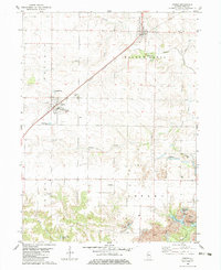
1982 Map of Oneida
USGS Topo · Published 1983About this map
Oneida and Altona serve as the primary hubs in this agricultural and industrial landscape of Knox County, defined by the diagonal path of the Burlington Northern railroad. The map documents a transition from traditional farming townships like Ontario and Walnut Grove to an intensive industrial zone in the southeast. Here, Strip Mines have altered the terrain, creating a series of reclaimed water bodies including Lake Windsor, Fishhook Lake, and Roundhouse Lake. For those tracing local history or family roots, the map identifies several burial sites such as Walnut Grove Cem, Larson Cem, and Scotch Cem. A notable geographic landmark, Pilot Knob, rises above the surrounding plains, while the presence of an Old Railroad Grade near Copley township points to earlier transportation networks that once supported the region's development.
Find a feature on this map
29 named features on this map. Tap any name to fly to it.
Don’t see what you’re looking for? This feature index may not catch every label — zoom into the map to look around manually.
Map Details
Editions of this 1982 Oneida Map
This is the sole edition of this map. No revisions or reprints were ever made.
Other maps of this area

1925 · Galesburg
USGS Topo · 1:62,500

1927 · Galesburg
USGS Topo · 1:62,500

1931 · Galva
USGS Topo · 1:48,000

1940 · Galva
USGS Topo · 1:62,500

1941 · Maquon
USGS Topo · 1:62,500

1943 · Maquon
USGS Topo · 1:62,500

1944 · Galva
USGS Topo · 1:62,500

1947 · Woodhull
USGS Topo · 1:62,500

1953 · Nekoma
USGS Topo · 1:24,000

1953 · Woodhull
USGS Topo · 1:24,000