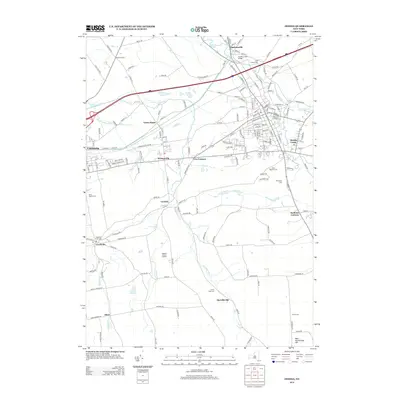
2013 Map of Oneida
USGS Topo · Published 2013About this map
Durhamville and the village of Oneida Castle anchor this detailed landscape in Madison County, where the historic path of the Erie Canal once shaped local industry. The terrain is defined by the winding course of Oneida Creek, crossed by the Oneida Creek Bridge, and supplemented by smaller waterways like Dutch Settlement Cr and Sconondoa Cr. This 2013 survey illustrates the dense network of rural roads connecting established hamlets like Wampsville and Clockville to more remote settlements such as Merrillsville and Alene. Local genealogy is well-supported by numerous burial grounds, including Saint Francis Cem, Saint Patricks Cem, and the Clockville Rural Cem. Notable landmarks such as Buttermilk Falls and the Madison County Landfill highlight the varied uses of the land, from natural features to essential infrastructure, while West Stockbridge Hill provides the primary topographic elevation in the southern portion of the quadrangle.
Find a feature on this map
162 named features on this map. Tap any name to fly to it.
Don’t see what you’re looking for? This feature index may not catch every label — zoom into the map to look around manually.
Map Details
Editions of this 2013 Oneida Map
This is the sole edition of this map. No revisions or reprints were ever made.
Other maps of this area

1895 · Chittenango
USGS Topo · 1:62,500

1895 · Oneida
USGS Topo · 1:62,500

1897 · Cazenovia
USGS Topo · 1:62,500

1898 · Oneida
USGS Topo · 1:62,500

1898 · Chittenango
USGS Topo · 1:62,500

1899 · Cazenovia
USGS Topo · 1:62,500

1902 · Chittenango
USGS Topo · 1:62,500

1902 · Morrisville
USGS Topo · 1:62,500

1902 · Oneida
USGS Topo · 1:62,500

1939 · Oneida
USGS Topo · 1:62,500