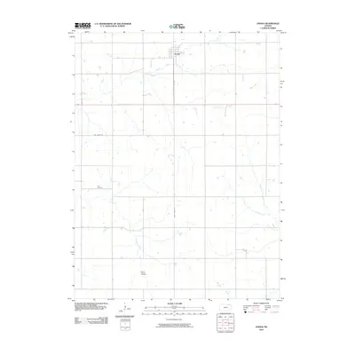
2009 Map of Oneida
USGS Topo · Published 2009About this map
Oneida serves as the central hub of this agricultural landscape in Nemaha County, where a highly organized grid of rural roads connects the surrounding farmsteads. The terrain is defined by a dense network of dendritic drainage systems, with Harris Creek and Craig Creek carving subtle valleys through the northern reaches, while Wolfley Creek and Tennessee Creek drain the southern portion of the quadrangle. This 2009 survey highlights the enduring rural layout of the region, anchored by historical landmarks like Ford Cemetery in the west and Mount Calvary Cemetery to the south. Local transit and access are facilitated by well-established routes such as Oak Grove Rd and Goff Oneida Rd, reflecting the long-term transportation patterns used by generations of farming families to move goods and reach the nearby rail corridor.
Find a feature on this map
12 named features on this map. Tap any name to fly to it.
Don’t see what you’re looking for? This feature index may not catch every label — zoom into the map to look around manually.
Map Details
Editions of this 2009 Oneida Map
This is the sole edition of this map. No revisions or reprints were ever made.
Other maps of this area

1888 · Hiawatha
USGS Topo · 1:125,000

1889 · Seneca
USGS Topo · 1:125,000

1894 · Seneca
USGS Topo · 1:125,000

1894 · Hiawatha
USGS Topo · 1:125,000

1950 · Kansas City
USGS Topo · 1:250,000

1954 · Kansas City
USGS Topo · 1:250,000

1955 · Manhattan
USGS Topo · 1:250,000

1956 · Manhattan
USGS Topo · 1:250,000

1956 · Kansas City
USGS Topo · 1:250,000

1957 · Manhattan
USGS Topo · 1:250,000