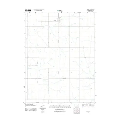
2012 Map of Oneida
USGS Topo · Published 2012About this map
Oneida Cem sits at the northern edge of this agricultural landscape in Nemaha County, where the township is defined by a rigorous grid of section-line roads and the winding drainage of Tennessee Cr. The transition of regional transportation is evident along the northern corridor where Old Hwy 36 runs parallel to more modern routes. To the west, the Ford Cem remains a primary landmark for local genealogy, situated near the intersection of Steele Rd and the creek. The area is characterized by its drainage network, including the headwaters of Muddy Cr, Wolfley Cr, and Craig Cr, which carve through the farmland. These creeks and the established road names like Goff-Oneida Rd and Springtown Rd highlight the enduring connectivity between small rural hubs.
Find a feature on this map
20 named features on this map. Tap any name to fly to it.
Don’t see what you’re looking for? This feature index may not catch every label — zoom into the map to look around manually.
Map Details
Editions of this 2012 Oneida Map
This is the sole edition of this map. No revisions or reprints were ever made.
Other maps of this area

1888 · Hiawatha
USGS Topo · 1:125,000

1889 · Seneca
USGS Topo · 1:125,000

1894 · Seneca
USGS Topo · 1:125,000

1894 · Hiawatha
USGS Topo · 1:125,000

1950 · Kansas City
USGS Topo · 1:250,000

1954 · Kansas City
USGS Topo · 1:250,000

1955 · Manhattan
USGS Topo · 1:250,000

1956 · Manhattan
USGS Topo · 1:250,000

1956 · Kansas City
USGS Topo · 1:250,000

1957 · Manhattan
USGS Topo · 1:250,000