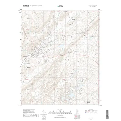
2018 Map of Oneonta
USGS Topo · Published 2018About this map
Oneonta serves as the primary hub of this north-central Alabama landscape, where the ridge-and-valley topography of the Cumberland Plateau dictates the layout of modern roads and older settlements. The map illustrates a transition from the urban grid of the county seat to the outlying hamlets of Champion and Eastwood. Water features such as Highland Lake and Whited Lake are prominent, while the Calvert Prong Little Warrior River and Blackburn Fork Little Warrior River drain the surrounding heights of Sand Mountain and Straight Mtn. Genealogists will find notable value in the location of rural burial sites like Liberty Cem, Valley View Cem, and Clements Cem. The distinct gap at Taits Gap and the geologic corridor of Murphree Valley highlight how the natural terrain has funneled human movement and settlement for generations.
Find a feature on this map
160 named features on this map. Tap any name to fly to it.
Don’t see what you’re looking for? This feature index may not catch every label — zoom into the map to look around manually.
Map Details
Editions of this 2018 Oneonta Map
This is the sole edition of this map. No revisions or reprints were ever made.
Other maps of this area

1885 · Gadsden
USGS Topo · 1:125,000

1888 · Cullman
USGS Topo · 1:125,000

1888 · Gadsden
USGS Topo · 1:125,000

1889 · Springville
USGS Topo · 1:125,000

1889 · Birmingham
USGS Topo · 1:125,000

1892 · Cullman
USGS Topo · 1:125,000

1892 · Birmingham
USGS Topo · 1:125,000

1892 · Springville
USGS Topo · 1:125,000

1892 · Gadsden
USGS Topo · 1:125,000

1895 · Gadsden
USGS Topo · 1:125,000