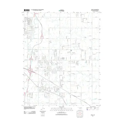
2012 Map of Oneta
USGS Topo · Published 2012About this map
Oneta and New Tulsa serve as the primary residential hubs in this suburban and rural landscape east of the regional core. The area is defined by a dense grid of section line roads, including E 31st St S and E 71st St S, which overlay a naturally dissected terrain carved by several drainages. Small local cemeteries such as Smith Cem, Springtown Cem, and Bailey Cem provide important reference points for genealogists tracing family histories in these rural outskirts. The hydrology is dominated by the meandering paths of Adams Cr and Coal Cr, which flow through the northern and central portions of the quadrangle. Significant transportation corridors, including the Muskogee Turnpike, intersect the grid, illustrating the modern connectivity of this region while preserving older local names like Fair Oaks Rd and S Oak Grove Rd.
Find a feature on this map
71 named features on this map. Tap any name to fly to it.
Don’t see what you’re looking for? This feature index may not catch every label — zoom into the map to look around manually.
Map Details
Editions of this 2012 Oneta Map
This is the sole edition of this map. No revisions or reprints were ever made.
Other maps of this area

1896 · Okmulgee
USGS Topo · 1:125,000

1900 · Okmulgee
USGS Topo · 1:125,000

1901 · Claremore
USGS Topo · 1:125,000

1914 · Claremore
USGS Topo · 1:125,000

1916 · Claremore
USGS Topo · 1:125,000

1946 · Fort Smith
USGS Topo · 1:250,000

1954 · Tulsa
USGS Topo · 1:250,000

1955 · Mingo
USGS Topo · 1:24,000

1955 · Broken Arrow
USGS Topo · 1:24,000

1957 · Leonard
USGS Topo · 1:24,000