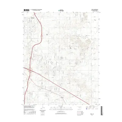
2016 Map of Oneta
USGS Topo · Published 2016About this map
The expanding suburbs of eastern Tulsa meet the rural reaches of Wagoner County in this contemporary Oklahoma landscape. Major transportation arteries including the Creek Tpke and Muskogee Tpke define the modern layout, facilitating growth between the historic settlements of Oneta and Coweta. Despite the increasing residential development seen in the gridded streets of New Tulsa and Fair Oaks, the map preserves the locations of several important family landmarks and rural burial grounds such as Smith Cem, Springtown Cem, and Bailey Cem. Drainage for this region is provided by the winding paths of Adams Cr and Coal Cr, which flow toward the Big Bottom lowland in the northeast. The presence of these small creeks alongside modern turnpikes illustrates the transition from traditional agricultural land use to a modern commuter-based economy.
Find a feature on this map
134 named features on this map. Tap any name to fly to it.
Don’t see what you’re looking for? This feature index may not catch every label — zoom into the map to look around manually.
Map Details
Editions of this 2016 Oneta Map
This is the sole edition of this map. No revisions or reprints were ever made.
Other maps of this area

1896 · Okmulgee
USGS Topo · 1:125,000

1900 · Okmulgee
USGS Topo · 1:125,000

1901 · Claremore
USGS Topo · 1:125,000

1914 · Claremore
USGS Topo · 1:125,000

1916 · Claremore
USGS Topo · 1:125,000

1946 · Fort Smith
USGS Topo · 1:250,000

1954 · Tulsa
USGS Topo · 1:250,000

1955 · Mingo
USGS Topo · 1:24,000

1955 · Broken Arrow
USGS Topo · 1:24,000

1957 · Leonard
USGS Topo · 1:24,000