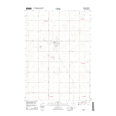
2015 Map of Onida
USGS Topo · Published 2015About this map
Onida serves as the central hub of this prairie landscape, situated in Sully County during the mid-2010s. The town's grid is anchored by S Main St and Ash Ave, with residential streets like Cedar Ave and Dogwood Ave defining the local community. To the west of the town center, the Onida Municipal Airport is a notable landmark, with Field Stone Dr leading toward its facilities. The surrounding terrain is meticulously organized by the Public Land Survey System, with township boundaries such as t114n r77w and t115n r77w marking the expansive agricultural sections. A network of section-line roads, including 304th Ave and 185th St, illustrates the systematic development of the South Dakota plains, connecting isolated farmsteads to the commercial heart of the county seat.
Find a feature on this map
36 named features on this map. Tap any name to fly to it.
Don’t see what you’re looking for? This feature index may not catch every label — zoom into the map to look around manually.
Map Details
Editions of this 2015 Onida Map
This is the sole edition of this map. No revisions or reprints were ever made.
Other maps of this area

1953 · Huron
USGS Topo · 1:250,000

1954 · Pierre
USGS Topo · 1:250,000

1954 · Huron
USGS Topo · 1:250,000

1958 · Pierre
USGS Topo · 1:250,000

1965 · Agar SW
USGS Topo · 1:24,000

1965 · Agar
USGS Topo · 1:24,000

1965 · Sully Lake
USGS Topo · 1:24,000

1967 · Onida SE
USGS Topo · 1:24,000

1967 · Onida SW
USGS Topo · 1:24,000

1967 · Blunt
USGS Topo · 1:24,000