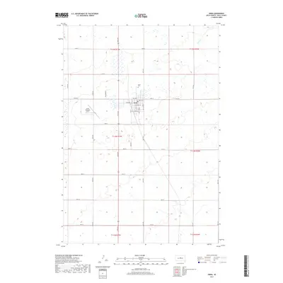
2017 Map of Onida
USGS Topo · Published 2017About this map
Onida serves as the focal point of this Sully County landscape, situated within an expansive grid of section lines and prairie townships. The town's layout is clearly defined by north-south avenues like S Main St and east-west thoroughfares such as Ash Ave. Just to the north, the Onida Cem provides a point of interest for genealogists and local historians, while the Onida Municipal Airport to the west marks the area's modern infrastructure. The map illustrates the transition of regional travel, showing Old Us Hwy 83 alongside contemporary routes like 304th Ave. This survey captures the characteristic South Dakota plains geography, where small settlements act as vital hubs for the surrounding rural sections.
Find a feature on this map
38 named features on this map. Tap any name to fly to it.
Don’t see what you’re looking for? This feature index may not catch every label — zoom into the map to look around manually.
Map Details
Editions of this 2017 Onida Map
This is the sole edition of this map. No revisions or reprints were ever made.
Other maps of this area

1953 · Huron
USGS Topo · 1:250,000

1954 · Pierre
USGS Topo · 1:250,000

1954 · Huron
USGS Topo · 1:250,000

1958 · Pierre
USGS Topo · 1:250,000

1965 · Agar SW
USGS Topo · 1:24,000

1965 · Agar
USGS Topo · 1:24,000

1965 · Sully Lake
USGS Topo · 1:24,000

1967 · Onida SE
USGS Topo · 1:24,000

1967 · Onida SW
USGS Topo · 1:24,000

1967 · Blunt
USGS Topo · 1:24,000